Troops battling time to get hundreds evacuated as cyclone looms
Defence forces are racing against the clock to evacuate almost 700 residents from a remote Northern Territory community hours before the eye of Tropical Cyclone Megan is expected to hit.
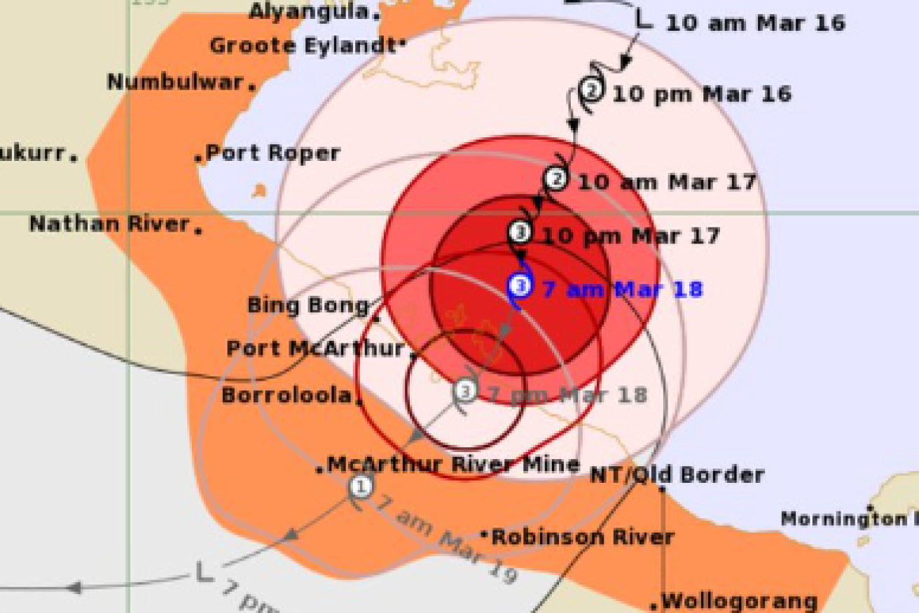
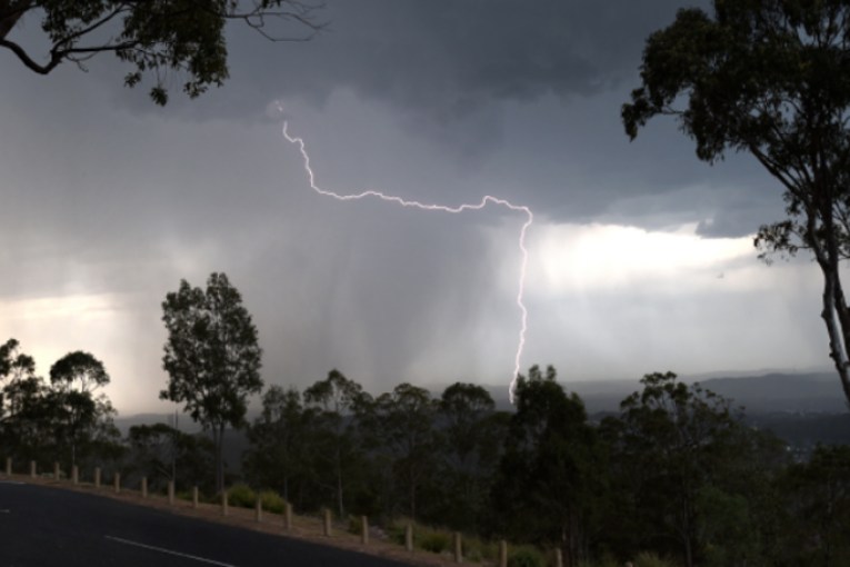
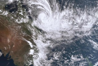
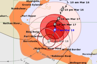
The eye of the severe weather system was sitting 120km from Borroloola on Monday morning and is expected to cross land sometime in the afternoon, bringing gusts of more than 200 km/h and heavy rainfall.
NT emergency services called in the Australian Defence Force on Monday to help evacuate hundreds of people living in the path of the category three cyclone.
The BOM says flood warnings could expand as the cyclone hits the coast on Monday evening. (Groote Eylandt & Bickerton Island Enterprises (GEBIE))
Chief Minister Eva Lawler said the evacuees will be taken to Darwin evacuation centres, which were being set up on Monday morning.
“We’ve been watching very closely, it’s very tight, very intense … we’ve been tracking it for nearly a week,” she said.
Assistant Police Commissioner Matt Hollamby said vulnerable people will be evacuated first, but the flooded airstrip in Borroloola has been making evacuations difficult.
“We have a contingency plan in place in the event that the aircraft can’t evacuate,” he said.
A smaller ADF plane is set to evacuate residents to a nearby larger plane to ferry them to Darwin.
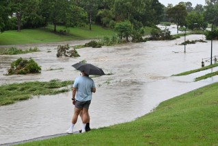
Groote Eylandt residents were hit with almost 600 millimetres of rain over the weekend as Megan made its way over the remote island communities.
The wharf on the GEMCO manganese mine has been damaged alongside the highway connecting communities.
Water and power outages have also been intermittent on the island.
The weather system intensified to a category three on Sunday with the Bureau of Meteorology warning there was a 20 per cent chance of it developing into a category four by Monday night.
“Severe Tropical Cyclone Megan is beginning to impact the southwestern Gulf of Carpentaria coast,” the Bureau of Meteorology advised at 8pm (ACST) on Sunday.
The cyclone is forecast to hit the NT coast on Monday evening with a warning area spanning hundreds of kilometres – from Alyangula on Groote Eylandt in the NT to the Queensland border and inland to Borroloola, the McArthur River Mine and Robinson River.
“There is a moderate chance that this system could develop into a category four tropical cyclone,” the bureau’s Shenagh Gamble said on Sunday.
The core of the cyclone has been called destructive, bringing wind gusts of up to 220km/h and rainfall totals of between 300 and 400mm.
Ms Gamble said the cyclone would likely remain a category three when it made landfall on Monday night but could intensify if it slowed down before then.
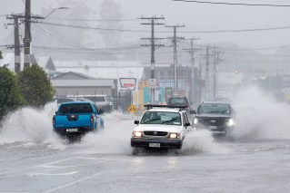
Possible rainfall totals of between 150 and 200mm and wind gusts of up to 110km/h were forecast in the other hundreds of kilometres of warning zone and dozens of towns.
Flood watches are in place for the Carpentaria to Arnhem and Barkly.
The bureau said the flood warnings could expand as the cyclone hits the coast.
The weather system is expected to return to a tropical low as it heads further inland on Tuesday and Wednesday.
Megan has formed a month after category one ex-tropical Cyclone Lincoln crossed the territory’s coast in the southern Gulf of Carpentaria, bringing high winds and heavy rainfall.