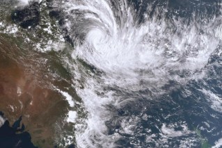
Remember Cyclone Lincoln? Now a tropical low, it’s still dumping rain where it’s most needed
Ex-Tropical Cyclone Lincoln is dumping what could be welcome rain for farmers in Western Australia’s wheat belt, while most flood alerts have been downgraded.

A general view of the mixed grains farm owned by the President of the Western Australian Farmers Federation Rhys Turton near York in the Wheatbelt region, 100km east of Perth on Tuesday, May 19, 2020. China today imposed an 80% tariff on barley imports from Australia. Barley usually makes up about 30% of his total crop but he will now be substituting most of his barley for other grains. (AAP Image/Richard Wainwright) NO ARCHIVING
Heavy rain and strong winds are moving southeast through parts of the state’s interior on Sunday after the weather system crossed the coast near Carnarvon on Saturday night.
The system is a tropical low however many people have still experienced plenty of rain. Falls of up to 40mm were recorded in the central west in the 24 hours to 9am on Sunday (AWDT).
Since 7am on Saturday, Carnarvon received 78mm of rain. At Geraldton, wind gusts of up to 76km/h were recorded.
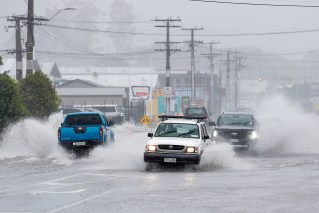
The State Emergency Service reported about a dozen calls due to the tropical low, as of Sunday afternoon, most in relation to homes that required sandbagging.
The Bureau of Meteorology said the ex-cyclone is expected to move south towards WA’s wheatbelt on Sunday before dissipating on Monday.
Senior meteorologist Angus Hines told AAP some may welcome the conditions.
“The rain moving into these areas, particularly around the wheatbelt will be very welcome for what has been a very hot and very dry summer so far for that part of the country,” he said.
Rain of up to 50mm is predicted for areas in Lincoln’s path but there is a chance of severe storms and higher falls.
People in the remote community of Sturt Creek in the Kimberley region are on flood alert.
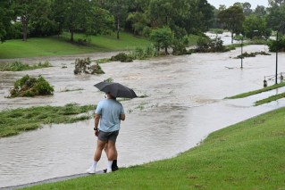
Authorities are asking residents to prepare for minor flooding. People are being urged not to walk or play in floodwaters, and protect themselves against mosquitoes and debris by wearing strong shoes and long, loose-fitting clothing.
Meanwhile flood watches have been cancelled for the Pilbara, Gascoyne Coast and Central West District rivers.
Lincoln crossed the Northern Territory coast from the Gulf of Carpentaria as a category 1 cyclone before moving inland across the Top End and into WA as a storm.
It dumped heavy rain across a wide area triggering flood watches and warnings in northwest Queensland, the NT and northern WA before moving offshore again on Wednesday.