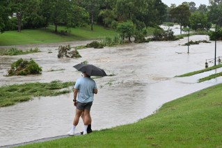
Nothing ordinary about Cyclone Jasper as it tracks toward Qld coast
“Unusual” tropical cyclone Jasper is heading across the Coral Sea and may threaten the Queensland coast by early next week.

An unusual tropical storm, Jasper is heading for Queensland. Image: AAP
Tropical Cyclone Jasper is currently a category one system moving slowly south after developing over the Solomon Sea, the Bureau of Meteorology said.
It may intensify into a category four system by Thursday.
“We are generally expecting it to continue developing through today and tomorrow, likely reaching that severe tropical cyclone category strength,” a bureau spokesperson told AAP on Wednesday.
Jasper is not only the first tropical cyclone of the season but is also believed to be the first to form off Australia in December during an El Nino.
“It is rare to see a December cyclone let alone one where we do have El Nino,” the bureau spokesperson said.
“It is unusual to be seeing this. There aren’t too many cyclones we have seen through the month of December let alone early December.”
Jasper may move toward the Queensland coast as it tracks south, southwest through the Coral Sea.
However the bureau was unsure what parts of the state would be impacted by the system.
“There are a few different ways it could play out as it moves,” the bureau said.
“There is still a degree of uncertainty about where exactly on the Queensland coast it might most affect.
“It is a pretty slow track at this point, in some ways it is giving people time to prepare – having a bit of preparation time for this cyclone as it does approach the Queensland coast is in people’s favour.”
Recent modelling suggests Jasper may approach the Queensland coast between Cooktown and Mackay, in the state’s north.
“Other potential outcomes are a more southerly track, consequently moving the system towards the Queensland coast south of Mackay or a slow moving system that remains over the Coral Sea beyond the next seven days,” the bureau said.
Even if Jasper doesn’t arrive in Queensland as a cyclone, the state may still be impacted by strong winds and heavy rain.
“It is broadly looking like it is coming within the vicinity of the Queensland coast, and bringing at least some windier conditions and some increased precipitation along parts of the Queensland coast,” the bureau said.
“Even if it is no longer a cyclone or a weakened cyclone, we can still see heavy rainfall and affects on the ocean like storm surges and storm tides from the cyclone regardless of its strength.”