Drenching rain in south east just the warm-up: 5cm hail on its way, says Bureau
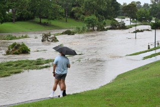
Two people have been rescued from a car swept up in floodwaters and others from a home on the NSW south coast as severe weather threatens to wreak havoc across Australia’s east coast.

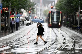
A jogger is seen at Dudley Page Reserve as a large storm moves over the CBD in Sydney, Monday, January 4, 2021. A severe thunderstorm warning has been issued for parts of the Blue Mountains, Hawkesbury and Sydney areas, with large hailstones, damaging winds and heavy rain expected. (AAP Image/Dean Lewins) NO ARCHIVING
Heavy rainfall across the region on Wednesday morning prompted two flood rescue missions at South Nowra and St Georges Basin, the NSW State Emergency Service said.
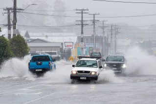
More heavy rainfall, thunderstorms, large hail and damaging wind gusts are expected to escalate throughout the day and into Thursday.
Parts of southern Queensland and northern NSW are bracing for giant hail more than 5cm in diameter and destructive winds of more than 125km/h.
At the other extreme, severe heatwave conditions in north Queensland are expected to build along the east coast and extend south before easing on Friday.
Bureau of Meteorology senior meteorologist Jonathan How said forecasters were expecting widespread rain and storms from southern Queensland through to southern Victoria in coming days.
Severe thunderstorms are forecast to extend into northeastern parts of NSW after conditions eased in Adelaide following flooding and disruptions.
Mr How said rainfall was due to pick up in NSW from early Wednesday, with the potential for six-hour totals of up to 50mm leading to flash flooding and damaging winds in excess of 90km/h.
“On Wednesday, we see the severe thunderstorm risk extend to the coast taking in Brisbane, Sydney and Canberra,” he said.
Parts of southern Queensland and northern NSW – including Toowoomba, Dalby, Moree and Tamworth – could see destructive winds of more than 125km/h and giant hail.
NSW catchments including the Peel and Namoi rivers are on flood watch while minor to isolated major flooding is forecast in Victoria for the Otways, Surf Coast and Wilsons Promontory.
Flood warnings were also in place in Queensland for the Moonie River and Wallam Creek, Mungallala Creek and the Paroo and Barcoo rivers.
Some far north Queensland centres have recorded a string of days in the mid-to-high 30Cs, which are forecast to continue to at least the end of the week.