37 degrees: Hottest day in three years tipped in SEQ but southerners look for snow
The thunderstorms are back and expected to roll into the south east as early as Wednesday evening but more likely Thursday after days of scorching weather, but in the southern states they’re looking out for snow later this week.

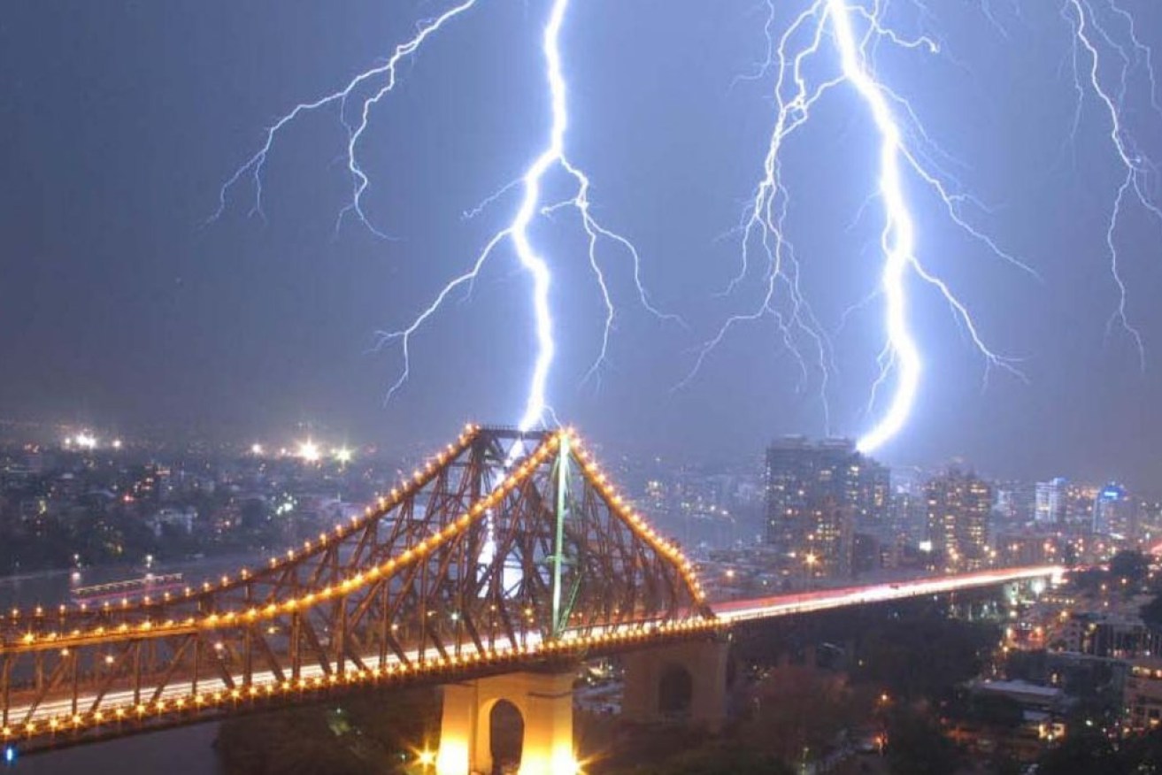
Storms are predicted to hit today and tomorrow ahead of a cool change late Thursday.
The heatwave in Queensland is expected to continue tomorrow with Brisbane tipped to hit a top of 37 degrees and possible storms. If it reaches that level it would be the warmest day since December 2019, according to the Bureau of Meteorology.
The north west and centre of the state was also experiencing a severe heat wave. Cloncurry, Charleville and Longreach were all expected hit at least 42 degrees.
Thunderstorms potentially severe were likely to develop on the Darling Downs and Granite Belt this evening and move through to the coast overnight into Thursday. Then further severe storms likely during Thursday afternoon and evening.
The Bureau of Meteorology’s forecast is for maximum temperatures to rise into the 40s in central and western parts with overnight minimum temperatures up to the high twenties.
The heatwave conditions have prompted warnings from the Palaszczuk Government for Queenslanders to take care.
Industrial Relations Minister Grace Grace said employers had an obligation to protect their workers from heat related illness under work health and safety laws.
“The sizzling Queensland summer is officially here, and the high temperatures in the last couple of days are a timely reminder to look out for your colleagues and staff in the heat,” Ms Grace said.
“In 2020 a worker collapsed and died after picking fruit on a farm in high temperatures, and in 2021 a North Queensland worker died from multiple organ failure due to heat related illness.
“In both cases, the businesses involved were prosecuted and fined for failing to comply with health and safety duties.”
The hot days should last until the weekend.
“In eastern areas, maximum temperatures will rise to the mid to high 30s with overnight minimum temperatures up to the mid-twenties. Temperatures would continue to rise later in the week, with heatwave conditions intensifying and extending in area.
“Locations likely to be impacted include Brisbane Metropolitan Area, Burketown, Cloncurry, Croydon, Camooweal, Doomadgee, Georgetown, Hughenden, Mount Isa and Normanton.”
BoM said the tropical activity was expected to increase during next week which would help to “flush out” stagnant heat.
But further south, in southern NSW, Victoria and Tasmania, they’re expecting snow falls later this week … in December. Two unseasonably cold snaps are tipped by Weatherzone.
“Both of these systems should deliver summer snowfalls to elevated parts (of Victoria, southern NSW and Tasmania) amd while snow accumulation likely won’t be heavy, temperatures will definitely be chilly by December standards,” Weatherzone forecasters said.
There were six snowfalls in October and November and occur when Southern Ocean air is pushed north.