Deluge continues as Victoria joins NSW on flood watch list
With more than 100 flood warnings current, NSW residents are bracing for another wet week as is much of the rest of eastern Australia.

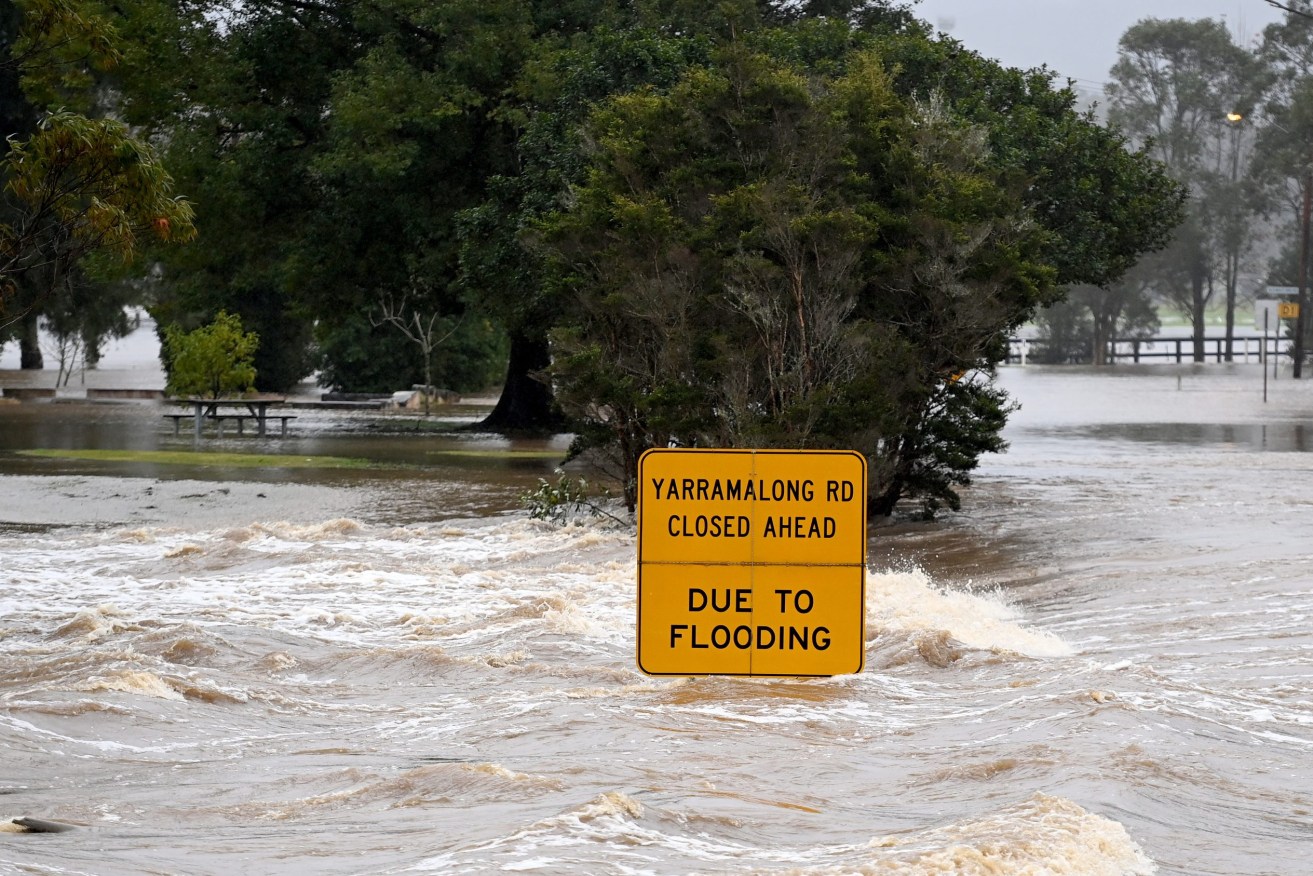
Floodwaters flow through Yarramalong cutting off the town on the Central Coast, north of Sydney. NSW residents are bracing for more heavy rain and flooding as dangerous downpours continue throughout the day. (AAP Image/Jeremy Piper)
While the sunshine is doing its best for now, heavy rain is expected to lash the western and southern parts of the state on Wednesday and Thursday.
Seven rivers could experience flooding in the coming days, the Bureau of Meteorology said.
Major inundation is occurring along the Murrumbidgee with the Riverina town of Gundagai on high alert and flooding is also possible downstream at major regional centre Wagga Wagga.
Other areas of concern include Gunnedah and Wee Waa in northwestern NSW, Warren, west of Dubbo, and Forbes in the central west.
Evacuation orders are current for parts of Dubbo, Wagga and the Hawkesbury, north of Sydney.
SES volunteers have responded to more than 1000 calls for help since Friday evening, including 155 in the past 24 hours, and conducted six rescues.
Some 450 emergency volunteers in the field are stretched throughout the state “literally border to border at the moment”, Deputy SES Commissioner Daniel Austin told ABC TV on Tuesday.
Numerous rivers are at major flood levels, particularly in the north and west of the state.
The Murrumbidgee River was at 9.04 metres at Gundagai early on Tuesday, with moderate flooding expected at Wagga in the coming days.
There is prolonged flooding along the Lachlan River, which peaked at Cowra near the moderate flood level on Monday afternoon.
The main flood peak is expected to reach Nanami on Tuesday afternoon, bringing major flooding.
At Forbes, the Lachlan River is likely to peak near 10.40m, just below the major flood level, on Wednesday, bringing major flooding to Cottons Weir and Jemalong.
The Namoi River at Gunnedah peaked at 7.75m on Monday night, with the main flood peak now downstream of Boggabri and expected to reach Narrabri on Wednesday.
On the Hawkesbury River, the level at Penrith fell below the minor flood level on Monday.
Victorians are being urged to enjoy the warm weather while it lasts, with the State Emergency Service and BOM bracing for flooding in the next few days.
“This event is probably the most significant rain event widespread across the state this year, certainly the most significant in recent months,” BOM senior meteorologist Kevin Parkin told reporters in Melbourne on Tuesday.
“We’ve got a short-term flash flood risk as a result of that rainfall intensity and then a longer-term riverine flooding risk,” he said.
Watch and act flood warnings have been issued for several rivers across the state, with the SES urging Victorians not to camp near streams and rivers this weekend and avoid driving to northern parts.
The heaviest rain is expected to arrive on Thursday, with up to 100mm in some areas.
In Queensland, minor flood warnings are current for the Bulloo, Lower Macintyre, Paroo, Bokhara and Barcoo rivers, while northern Tasmania is also set to face heavy rain between Wednesday and Friday, with up to 100mm expected in some parts.
The BOM has meanwhile released its severe weather long-range forecast into 2023.
It expects an increased risk of tropical cyclones and tropical lows and widespread flooding for eastern and northern Australia.
While there is “normal bushfire potential” in the eastern states, there will be an elevated risk of grass fires in southern Australia and a higher risk of prolonged heatwaves with higher humidity
The forecast also warns of a possible increase in the risk of thunderstorm asthma events if 2023 conditions are dry in late spring and early summer.


