Look at that thing! Giant weather system covering east coast prompts insurance warning
When meteorologists refer to a weather pattern as “this thing is enormous” you know you’re in for trouble.

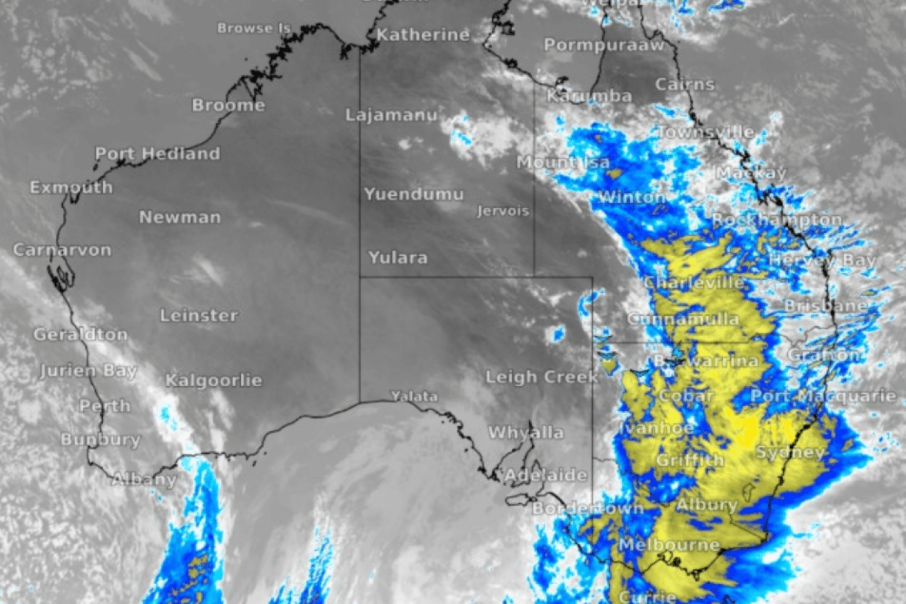
Weatherzone's map of the rain hitting eastern states
The Insurance Council of Australia has also warned people on Australia’s east coast to heed the implications of the three rainfall systems that are forecast to bring downpours to three states, including Queensland.
While NSW is already being hit with torrential rain, a second weather system is expected to nr even more widespread, with storms, rain and bursts of heavy falls forecast from Queensland to Southern Victoria from Thursday night and into Friday.
Weatherzone said the system hitting the east coast stretched from the Gulf of Carpentaria to Tasmania.
“Look at the size of that thing,” Weatherzone said.
“It’s a massive band of cloud and rain extending from the Gulf of Carpentaria to Bass Strait and beyond. Not all of the cloud in that system is generating rain although a lot of it is.”
“A series of low pressure troughs were expected to drag down moist tropical air from the Indian Ocean over the next week, bringing days of flooding rain to the already sodden landscape.”
The system is expected to impact the Northern Territory, Western Queensland, NSW, northern Victoria and South Australia today.
“Daily rainfall totals of 15 – 30 mm are forecast for southern Queensland, New South Wales, and Victoria increasing to 30 – 50 mm due to thunderstorms. Isolated rainfall totals up to 100 mm are possible,” the Bureau of Meterology said in a statement issued on Wednesday afternoon.
Following that there was expected to be a brief reprieve before rain starts again on Friday in southern states. Severe storms have also been predicted for western Queensland.
“The multi-day deluge comes as moisture-laden air streams in from the north with the Indian Ocean Dipole and La Nina in full effect.”
Your Weather Channel referred to the week ahead as “scary stuff” with the biggest impact hitting the Murray Darling Basin.
The Bureau of Meteorology said the coming rain was likely to lead to renewed river level rises across many already flooded rivers in NSW, Victoria, and southern Queensland, with widespread moderate to major flooding likely across inland NSW.
The Insurance Council said the 2021 and 2022 combined insurance damage bill for La Niña generated east coast storms and flooding stood at $5.92 billion with more than 296,000 claims lodged.
“Insurers are well prepared to respond to these events, but it is clear the community needs to be better protected from worsening extreme weather and that requires greater investment in mitigation and resilience,” the council’s chief operating officer Kylie Macfarlane said.
Flood Watches would be issued for many river catchments in NSW and Victoria, and some river catchments in southern Queensland and Tasmania ahead of anticipated rainfall.