Here we go again: Inland floods tipped as conditions ripe for another deluge
Another major rainfall event is on the way for Australia’s east coast as the full impact of the negative Indian Ocean Dipole hits.

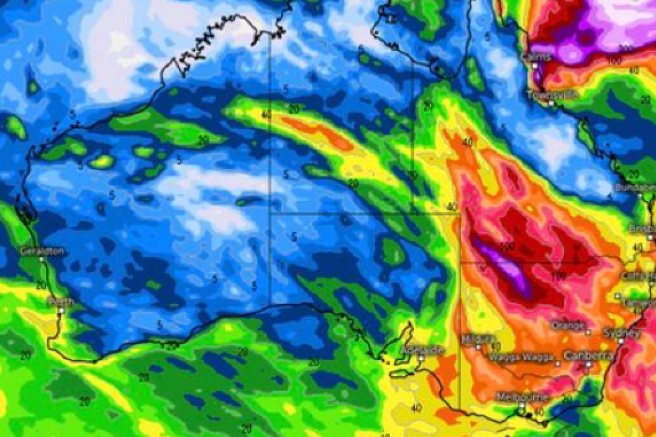
Your Weather Channel's forecast mapping for late August and September
“Strap yourselves in folks as September and spring is likely to be messy,” Your Weather Channel posted.
It issued a warning that Australia was likely to see the full force of the negative IOD over the next four to 12 weeks which will combine with the La Nina through spring and summer.
The forecasts have not been confirmed by the Bureau of Meteorology but Your Weather Channel, which has been accurate in its IOD predictions, said there was plenty of moisture filtering across the country with heaviest rains likely to be in the southern NSW and Victoria regions.
Its forecast said there were likely to be heavy falls across Queensland’s southern inland regions.
The prediction said things could change in the next two weeks but it said it was likely that many rivers in Queensland, NSW and Victoria would experience flooding, especially inland.
That was likely to lead to an influx into the already-full Darling River in NSW and the Murray River “which may go into moderate to major flooding” because the Hume Dam was already full.