More dam releases as flood-weary south east braces for next deluge
Southeast Queensland residents are on flood watch after intense rainfall hit soaked catchments with some dams releasing water ahead of another forecast drenching.
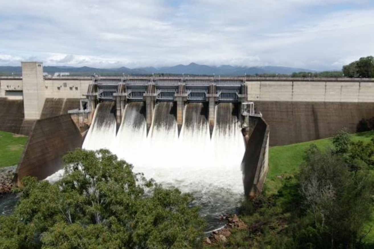
Several south east Queensland dams have opened their spill gates ahead of another wet day Sunday Image: SEQWater.
On the Sunshine Coast, Maroochydore copped more than 60mm in five hours on Saturday, and other areas recorded 100mm in 24 hours, as a low-pressure trough moved south along the coast from St Lawrence, north of Gladstone.
Up to 25mm is forecast to hit Brisbane and the southeast coast on Sunday with flood warnings in place for rivers and creeks between St Lawrence and Brisbane.
“The heaviest rainfall is expected along coastal parts,” the Bureau of Meteorology said in an alert.
“Minor flooding is possible across the Flood Watch area, which may lead to localised transport disruption and flooding in low lying areas close to rivers and creeks.”
Seqwater warned Pine Rivers and Moreton Bay Region residents that the North Pine Dam would start flood releases at 8pm on Saturday.
The utility said Youngs Crossing, downstream from the dam, would likely be inundated with Moreton Bay Regional Council closing the causeway at 7pm.
“If you are downstream of the dams, stay away from fast flowing or deep water near waterways and flood plains,” Seqwater said in an alert.
Smaller dams across between the Sunshine Coast and the NSW border have also been overflowing or releasing water on Saturday.
West of Brisbane, major flooding is possible along the Condamine River which is forecast to peak near 9.3 metres, above its major flood level, on Sunday morning.
Flooding is also on the cards downstream along the Balonne River with fresh surges expected over several days.
BOM forecaster Shane Kennedy says residents at Dirranbandi and Hebel could be isolated by floodwaters into next week.
“It’s just about preparing and making sure that everyone is loading up with supplies before that happens again,” he said.
“We’ve seen multiple peaks this season around throughout that Condamine and Balonne system.”
Light coastal showers are likely to continue through the week with central Queensland also in line for rain before conditions ease.
“Next weekend we might finally see a bit more sunshine in the southeast,” Mr Kennedy said.
Queensland has suffered five deadly floods since December, which scientists have put down to the second La Nina weather pattern in two years.