Darling Downpour: Alarms triggered, storm cell fears as flood focus turns west
Lockyer Valley residents are fleeing to higher ground ahead of major floods as severe storms bring intense rainfall, flash flooding and potential landslides to southern Queensland.
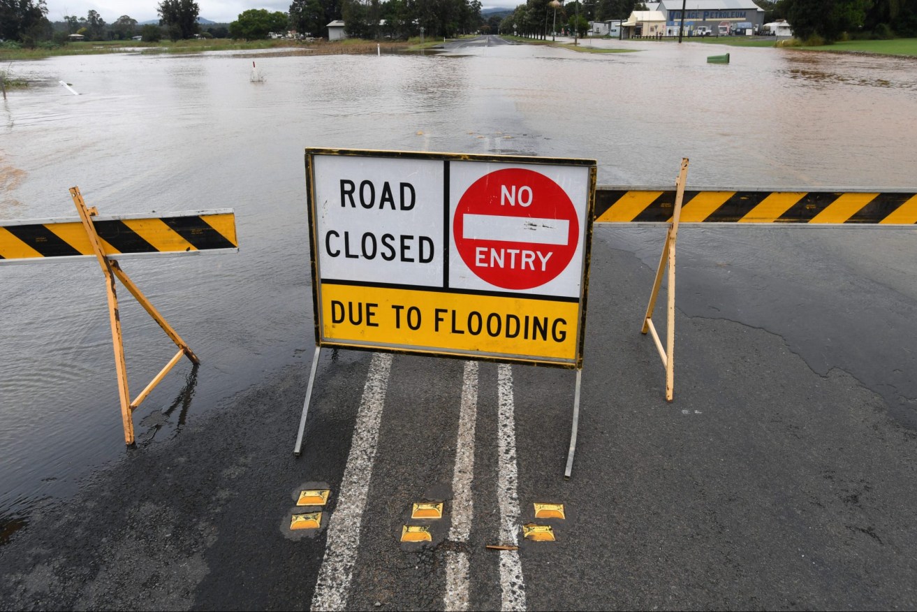
Floodwaters are seen in the town of Grantham, west of Brisbane. Queensland continues to be battered by an unseasonal rain band. (AAP Image/Darren England)
A massive low-pressure trough is dumping intense rainfall – up to 132mm in six hours – on Brisbane, Ipswich, Lockyer Valley, Darling Downs, Moreton Bay, the Sunshine Coast, Wide Bay-Burnett, Bundaberg and Gladstone.
Queensland Fire and Emergency Services swiftwater teams conducted seven rescues overnight and responded to more than 900 calls for help.
Evacuation sirens sounded at Grantham, west of Brisbane, on Friday morning with people in all low-lying areas of the Lockyer Valley urged to flee to higher ground as Lockyer Creek rapidly rises to a major flood level.
“Act now – do not wait for emergency services to knock on your door,” Lockyer Valley Regional Council said in an alert.
“The siren is intended to prevent any loss of life and relies on the community heeding the siren.”
About 120km southwest, Stanthorpe residents are also on alert as Quart Pot Creek continues to rise.
The Southern Downs Regional Council said the creek was already at a moderate flood level on Friday morning, with more intense rainfall forecast.
“If the situation worsens, warn neighbours, secure property and prepare to move to higher ground,” the council said in an alert.
The rain hitting south east Queensland would last at least a day longer than previous forecast, but flooding is only expected to be minor.
The Bureau of Meteorology said the weather event was “very much an evolving situation” but forecasts were now that it would not clear until tomorrow, 24 hours later than previously expected.
Premier Annastacia Palaszczuk said there had already been a lot of inundation, especially in catchment areas.
“This rainfall is not like the previous (February) event. It’s a lot more sporadic and not as heavy but there is still some flooding and rivers rising,” the premier said.
“We are not expecting to see the extent of damage we saw last time.
“If you were impacted by creeks and catchments last time you should be monitoring things and listening to your councils.”
Wivenhoe Dam was now at 110 per cent and the Premier said that in February it reached 185 per cent.
“So there is still plenty of flood storage available,” she said.
Controlled releases from dams had been occurring but they would be stopped as rivers rose with high tides.
Bureau forecast Laura Boekel said the Brisbane River peaked at high tide at 1.67 metres, just below minor flood level. She said by comparison the river hit 3.5 metres – major flood level – at the height of the February event.
The Bureau has warned six-hour rainfall totals of up 160mm on Friday could lead to life-threatening flash floods, and potential landslides, between Gladstone, Coolangatta and the Darling Downs.
QFES Assistant Commissioner Andrew Short said residents should reconsider their need to travel, with hundreds of roads already cut by floodwaters.
Almost 70 schools have already been closed.
“Currently, we’ve got 18 emergency alerts out in a number of councils,” he told ABC Radio on Friday.
“So we’re looking for people just to listen and respond and act accordingly.”
Brisbane City Council has suspended ferry services and opened sandbagging stations, with residents in flood-prone areas being advised to move their cars to higher ground.
The lower Brisbane River is expected to reach a minor flood level on Friday morning, but Emergency Services Minister Mark Ryan said updated forecasts of intense rain could pose a risk of flash flooding into Saturday.
“Those falls could be up to 160mm over six hours, so creek catchments could rise very quickly, particularly given the creek catchments are so water-saturated at the moment,” he told ABC Radio.
“Anyone who is in a creek catchment or river area needs to be very well aware of their circumstances because the rain can become heavy to intense very quickly, and that means that there is a severe risk of flash flooding.”
The Gold Coast has so far missed the most intense rainfall, but Mayor Tom Tate has opened sandbagging stations, warning of localised intense rainfall.
In Queensland’s north and west, moderate to major flooding is underway on the Cape, Condamine, Balonne, Thomson, Barcoo, Georgina, Kolan and Flinders rivers.
The unseasonal deluge is Queensland’s sixth deadly flood since December, which scientists have put down to a second La Nina weather pattern in two years.