Here comes another deluge: ‘Extraordinary rain’ to hit large areas of state next week
An extraordinary weather event is likely to hit large areas of Queensland from Tuesday with falls of 10 times the usual for May.

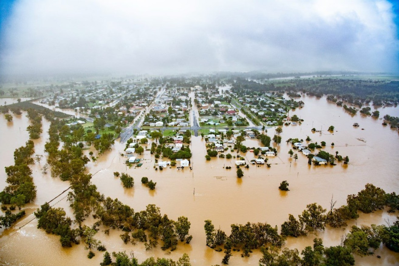
Areas still saturated from recent rain have been warned to expect 'extraordinary rain' in the coming days.(Supplied: Wayne Pratt/ABC)
Premier Annastacia Palaszczuk said the west and north of the state were the likely targets with the event expected to start on Tuesday. Falls of up to 200 mm were predicted.
“It’s going to be incredibly heavy rainfall so we want people to think carefully over the weekend,” the Premier said.
“We are looking at areas like Townsville and Ingham, all the way to Longreach, Winton, Windorah and Barcaldine. I know they received rain recently and they can expect a lot more.
“Of course this rain event will have impacts down as far as Rocky, Yeppoon and maybe even down to Gladstone.”
And the forecasts for Queensland was for above average rain for winter and spring as the weakening La Nina and the Negative Indian Ocean dipole combine.
It prompted a stern reminder from police commissioner Katarina Carroll for extreme caution in the next week.
“We have had a number of tragedies out of the last events – some 14 people passed away, the commissioner said.
“A lot of that was people driving through floodwaters or being caught in floodwaters obviously rising.
“Please do not drive through those flooded waters.”
The rain event contrasts to normal May falls for much of Queensland of 10 to 20mm.
The Premier said the disaster response management group would be stood up as soon as the event hits and local emergency groups were already preparing for a response.
The Deputy Premier would also be contacting relevant mayors to ensure they had planning in place.
“We do not expect this to be as intense in south east Queensland, so that’s a relief, however we will be monitoring it very carefully. Some of the streams and rivers have been saturated from our earlier weather event.
“It’s very unusual to see this type of situation occurring in far north Queensland, especially at this time of the year which is the end of the wet season, and we are expecting higher rainfall totals than we have seen before in May.
“We will be keeping people updated.”
Queensland Police Minister Mark Ryan said people in the more at risk areas should consider their supply situation and stock up if necessary.
The Bureau of Meteorology said the rain would impact many areas of Queensland that received recent heavy rainfall and catchments would still be saturated.
Local flash flooding was expected in these areas and a floodwatch was expected to be issued over the weekend.
“This rainfall at this time of year over such a wide area in conjunction with recent falls … any of the small catchments are going to be very responsive. Also where we have current or recent flooding they will be more prone to renewed rises with much less rainfall,” a BOM spokesman said.
It was less likely the southeast would experience heavy and flooding, but he said it could happen and there would be a risk of flash floods.
“We are going to see a trough system develop over inland parts of Queensland over the coming days. An upper level low pressure system will move across the state and generate this rainfall.
“It’s quite usual for this in May.”