Breakfast with Tiffany: North battens down as cyclone strengthens overnight
Tropical Cyclone Tiffany has strengthened to a category two storm and has made landfall in far north Queensland, the Bureau of Meteorology is reporting.
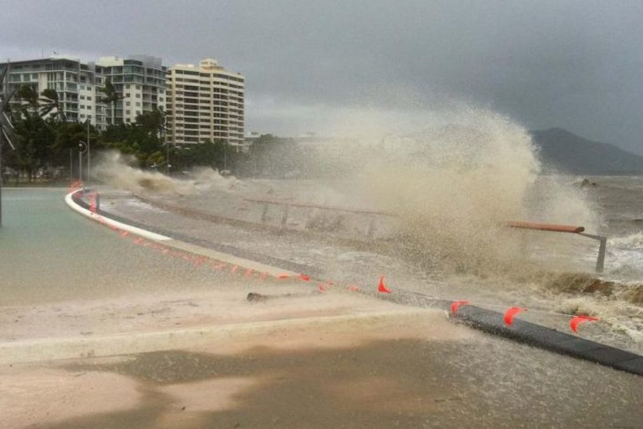
File photo of waves crashing on the Cairns waterfront during Cyclone Yasi. North Queensland is bracing for Cyclone Gabrielle which has formed off the coast but is not expected to make landfall.(Photo: ABC)
“People between Cape Tribulation and Coen, including Cooktown, should complete preparations quickly and be prepared to shelter in a safe place,” the bureau says.
The cyclone, which formed in the Coral Sea, crossed about 90 km south-east of Coen on the Cape York Peninsula, at about 2pm on Monday and is on a westward track.
Tiffany is forecast to emerge over the Gulf of Carpentaria on Tuesday morning.
The bureau is warning communities to expect wind gusts of up to 130km/h as the centre of the cyclone makes landfall.
It is expected to bring destructive winds and heavy rain to communities in far north Queensland before moving into the Gulf of Carpentaria on Tuesday and intensifying as it moves towards the Northern Territory coast.
Severe tropical cyclone coastal impact in the Northern Territory is possible on Wednesday or Thursday, the bureau says.
“People in far north Queensland communities will start seeing and feeling the effects of Tropical Cyclone Tiffany as it comes closer to the coast, which means an increased risk of flooding and some localised damage in these regions,” Senior Meteorologist Dean Narramore said.
Authorities are confident adequate measures are in place for Cooktown and Lockhart River.
“Our preparations are very good. We have high confidence in the shelters and the structures in the areas that are impacted,” State Disaster Co-ordinator Steve Gollschewski said.
“We have factored into our planning the cases of Covid that are currently in the Cape and that is well covered in our operational planning.
“Similarly for the emergency response that may need to come afterwards if we have loss of power, we have testing of those people in place before they go in, all of that is looking pretty good at this stage.”
Other parts of Queensland have already been struck by floodwaters with one person dead and an evacuation order issued for parts of the city of Maryborough.
Authorities had expected the river to peak in Maryborough above a major flood level of 10.5 metres, impacting about 80 homes on Sunday afternoon, after the remnants of tropical cyclone Seth dumped 600mm on the Wide Bay-Burnett region in two days.
The levee was protecting the CBD until an underground stormwater valve failed just before 2pm on Sunday, allowing floodwater to surge through the drains and into the streets.
A dozen pumps each moving about 120 litres a second appear to have kept the floodwaters at bay as the river peaked at about 10 metres late on Sunday night, the local mayor said.
A 22-year-old’s body was found in a submerged ute at Kanigan, north of Gympie, on Saturday.
Police also hold grave fears for a 14-year-old girl swept away while abandoning a flooding car.
On Sunday morning, Premier Annastacia Palaszczuk said emergency services were readying for the cyclone.
“So to all the residents in those areas please be on the lookout, I know that they know how to deal with these events,” she told reporters.
“They’re very well prepared and we’ll be keeping a very close eye on that.”