Wetter and stormier: Bureau makes it official – La Nina is back
The La Nina weather pattern is back for a return dose of cooler, wetter and stormier summers.

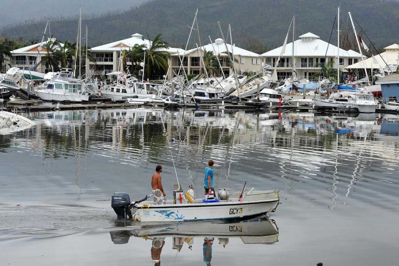
Cyclone Yasi caused $3.5 billion in damage
The Bureau of Meteorology made it official today, but American agencies had made the La Nina declaration some time ago and anyone who had tried to plan an outdoor event recently would have thought it obvious.
A La Nina also occurred last summer and back-to-back ones are not unusual. The last two-year La Nina was during the notorious years of 2010 to 2012, which included Cyclone Yasi and its devastation of parts of Queensland, leaving a $3.5 billion damage bill.
During La Ninas, cyclones are more common and can form as early as December, rather than January in normal years.
This year’s event was not expected to be as strong as the 2010-12 event and may even be weaker than the 2020-21 La Nina event.
The bureau’s head of operational climate services Dr Andrew Watkins said that typically during La Nina events, rainfall became focused in the western tropical Pacific, leading to wetter than normal periods for eastern, northern and central parts of Australia.
“La Nina also increases the chance of cooler than average daytime temperatures for large parts of Australia and can increase the number of tropical cyclones that form,” Watkins said.
“La Nina is also associated with earlier first rains of the northern wet season, as we’ve observed across much of tropical Australia this year.
“The last significant La Nina was 2010–12. This strong event saw large impacts across Australia, including Australia’s wettest two-year periods on record, and widespread flooding.
“La Nina also occurred during spring and summer of 2020-21. Back-to-back La Nina events are not unusual, with around half of all past events returning for a second year.”
“Every La Nina has different impacts, as it is not the only climate driver to affect Australia at any one time. ”
Bureau senior meteorologist Dean Narramore said parts of Queensland, NSW and Victoria would be lashed with heavy rain and thunderstorms from Wednesday.
During the next four days, he said eastern Queensland, eastern and central NSW, and Victoria’s north and east could receive between 50 and 100 millimetres of rain.
Rain and flooding is predicted to be at its worst between Thursday and Friday.
“These rainfall numbers, on already saturated soils, is likely to lead to renewed river level rises on many of our already-flooded rivers,” he said.
“If you are out and about in the coming days, particularly the northern and eastern parts of Victoria, inland NSW and southern inland Queensland, just be weather aware, check the radar, check the warnings.”