Frightening twist: BOM warns of tornadoes after wet and wild morning
Several days of warnings from the Bureau of Meteorology for wild weather and damaging storm cells finally arrived on Queensland’s south-east overnight with a series of powerful storms shaking the region from its slumber.
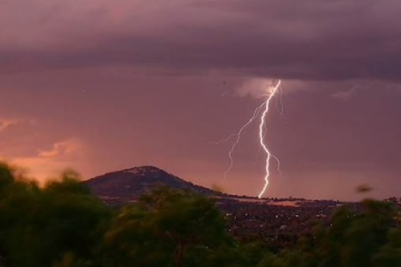
Powerful electrical storms carrying heavy rainfall lashed the south-east early this morning (Photo: ABC - Brett Clarke).
But the worst may be yet to come, with the chance of supercells, giant hail and even tornadoes later in the day.
Brisbane city picked up 51 millimetres in 24 hours and some areas to the east got up to 90mm.
Severe storm warnings for Brisbane, Moreton Bay, the south-east coast, parts of the Wide Bay and Burnett, the Darling Downs and Granite Belt were cancelled by mid-morning, however, senior Bureau of Meteorology forecaster Shane Kennedy said more were on the way.
BOM warns there is the potential for higher-end severe storms and supercell activity this afternoon.
Kennedy said there was an “outside chance” of tornadoes forming in inland areas like the Darling Downs.
BOM said the atmosphere was “very much primed” for storm activity throughout south-east Queensland for most of the day, possibly even stretching to Friday morning.
The Bureau of Meteorology (BOM) said severe cells formed over Somerset early Thursday morning and were moving east to be over Narangba, Burpengary and Moreton Bay about 7:30am
Severe thunderstorms were detected on the radar near the area west of Esk and the area northwest of Esk, with both moving east.
Senior forecaster Shane Kennedy said up to 26 millimetres of rain had fallen in just an hour in Brisbane Thursday morning.
Since 9:00am yesterday, 75mm had fallen in Brisbane’s east and 84mm at Wynnum on Brisbane’s bayside.
BOM forecaster Grace Legge said the storm cells would ease off later, before returning.
“We’ll probably have a little bit a bit of a break while the environment sort of re-charges, if you will, and we’ll start to see those thunderstorms again in the afternoon though and they could be quite severe today,” she said.
Senior forecaster Felim Hanniffy said “severe storms are likely about the south-east” throughout the day, which could bring “large hail, damaging winds and locally heavy rainfall.”
“There is potential for the higher-end severe storms for some supercell activity as well,” which carry the risk of “giant hail, destructive wind gusts and intense rainfall”.
Hanniffy said a trough “conducive” to severe storms posed a risk to areas south of Capricornia, but northern parts of the state could still see less-intense storms.
“You have to wait for them to form for us to pinpoint exactly, then that’s where the warnings come in play.”
“There’s still a potential for severe storm risk during the first part of Friday about the south-east until that trough moves through, and then we get this drier air following,” Hanniffy told the ABC.
“There’s still a potential for severe storm risk during the first part of Friday about the south-east until that trough moves through, and then we get this drier air following,” Hanniffy said.