Large hail, strong winds: Storms bear down on SEQ
Residents and businesses from Bundaberg to the NSW border have been warned of a line of approaching storms as the south-east Queensland region braces for its first bout of severe Spring weather.

The Bureau of Meteorology issued a warning that severe thunderstorms with likely large hail and damaging winds would hit the region on Thursday afternoon and evening.
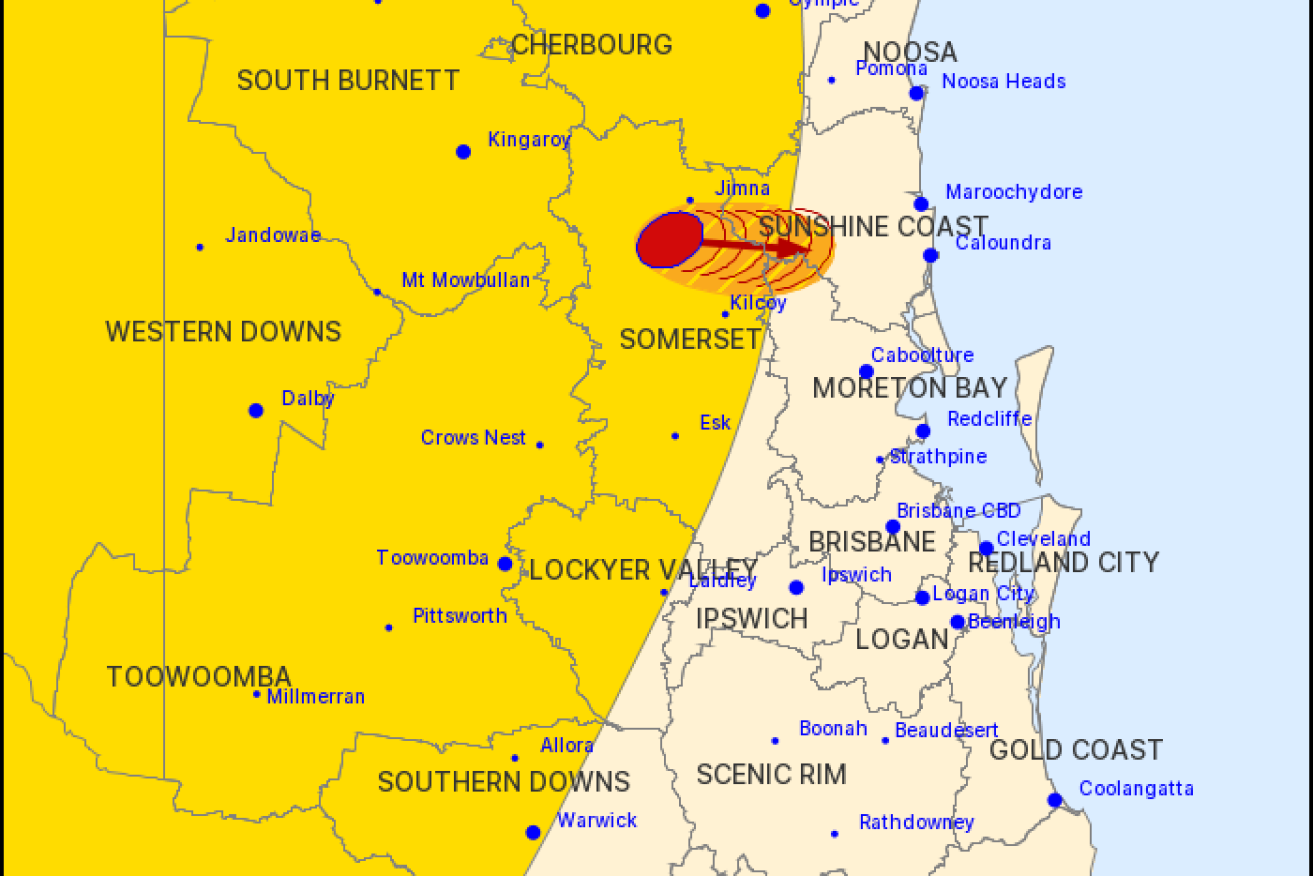
The bureau issued a warning soon after 3pm saying that severe thunderstorms were detected on the weather radar near the ranges south of Jimna near the Sunshine Coast but issued an update at 4pm saying the cell had weakened.
“These thunderstorms are moving towards the east. They are forecast to affect the area west of Conondale by 3:50 pm and Maleny, Conondale and the area north of Woodford by 4:20 pm,” it said.
In an earlier warning, the bureau identified Warwick, Toowoomba, Dalby, Gympie, Kingaroy, Goondiwindi and Gatton as places they might also be hit by storms.
“A broad upper trough combines with surface convergence across parts of Queensland today, which will produce thunderstorms into the afternoon and evening.”
Storms lashed the far west of the state on Wednesday as the trough moved east.