South-east to cop a weekend soaking as wild rain lashes NSW
South-east Queensland is battening down for another soaking this weekend as showers and rain from a slow moving weather system lashes the region while heavy rain in NSW has sparked flood warnings for greater Sydney and the state’s far west.

The Gold Coast is tipped to receive the worst of the weekend deluge. Photo: ABC
The Gold Coast is expected to wear the worst of the weather, with up to 90mm of rain expected at Cooloongatta and other parts of the coast over the weekend and swells rising to three metres by Sunday.
Brisbane is forecast to receive up to 45mm over Saturday and Sunday, while up to 70 mm is expected to fall on the Sunshine Coast.
The Bureau of Meteorology said a trough would remain over parts of the south-east into the weekend, deepening from Monday.
A coastal trough remains near stationary near the Capricornia and Central coasts, weakening as it slowly moves to the north.
“A high in the Tasman Sea maintains a weak ridge along the coast with a new coastal trough developing near the southeast coast on Saturday,” the bureau said.
The wet weather is expected to continue into next week.
In western Queensland, food warnings for a range of river systems remain in place.
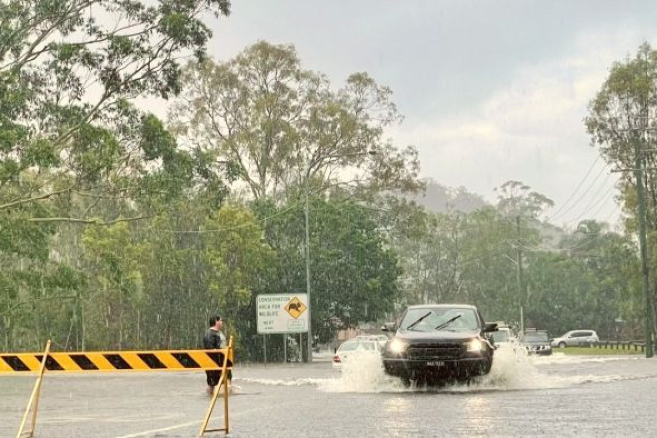
Overnight on Thursday, up to 100mm of rain fell across regional NSW, sparking more than 400 calls for help to the State Emergency Service.
SES crews have undertaken 11 flood rescues during the deluge, including three in western Sydney.
More heavy rain, thunderstorms and damaging winds are forecast on today and into the weekend, heightening the risk of flash flooding and hazardous surf and heavy swells.
Flood watch alerts have been issued for the mid-north coast, Hunter, Central Coast, Sydney metro and Illawarra coast and far west areas.
NSW SES assistant commissioner Sean Kerns admitted the service’s volunteers were preparing for a difficult weekend.
“We are responding as we get calls for assistance, we are putting warnings out to local communities. At this stage there is a flood watch for 23 river catchments,” Kerns said.
The biggest risk is on the mid-north coast where the Orara, Bellinger and Hastings rivers are being closely watched ahead of expected minor to moderate flooding.
The mid-north coast copped the worst of the conditions on Thursday as a low-pressure system moves south to the Hunter, Illawarra and Sydney.
Catchments are already soaked but it won’t take much more for flooding to occur, the Bureau of Meteorology’s Agata Imielska said.
“It’s the difference between being inconveniently wet to conditions drastically changing to being dangerously wet,” the meteorologist said.
The bureau said the low-pressure system was a “significant system” bringing peak gusts of more than 90km/h.
Towns likely to be affected by flooding include Coffs Harbour, Port Macquarie, Taree, Woolgoolga, Sawtell, Bellingen and Dorrigo.