Brief reprieve for sodden Gold Coast, with a damp Christmas on the cards
The Gold Coast will be granted a reprieve from wild weather today with conditions set to ease across south-east Queensland after a torrid week of heavy rain and flash flooding – but a wet Christmas may be on the way.
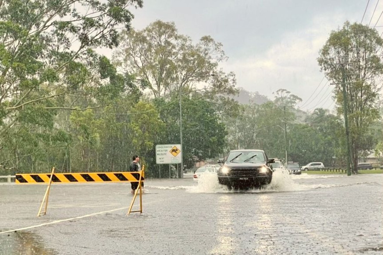
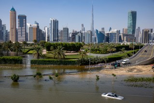
Flood warnings continue to be current across the state.(ABC News: Jennifer Huxley)
It comes after a deluge swamped the region with intense falls leaving many streets in Currumbin and Burleigh under water.
The Bureau of Meteorology (BOM) has cancelled all of its severe weather warnings for the region and said Thursday’s downpours would be replaced by occasional showers.
“Generally, our rainfall rates will ease across south-east Queensland, with heavy rainfall set to dissipate,” forecaster Rosa Hoff said.
“There is still the odd chance of a storm in some areas, but rain totals will be moderate to light.”
The southern end of the Gold Coast bore the brunt of Thursday’s wild weather, with Oyster Creek, near Burleigh Heads, recording 227 millimetres in the six hours to 1:00pm.
Tallebudgera Creek Road registered 190mm from 9:00am until 6:00pm, while Coolangatta recorded 135mm during the same period.
“A lot of those high-end totals across the state have been quite isolated, whereas in days gone by, we did see a lot of widespread rainfall round much of Queensland,” Ms Hoff said.
“This has seen small locations getting lots of rainfall, while the broader area only sees a handful of millimetres.
“For example, Gold Coast Seaway recorded less than 10mm yesterday [Thursday], which is nearly a 20th of what some locations have seen.”
The Gold Coast rain readings were even more significant when taken over the past seven days, with Upper Springbrook (1,087mm), Currumbin Creek (760mm), Upper Tallebudgera (727mm) and O’Reilly’s (683mm) leading the way.
Closer to the coastal fringe, Coolangatta saw 370mm fall over the past week, compared to 254mm for the Gold Coast Seaway.
The highest readings on the Sunshine Coast were at Maleny (321mm), Crohamhurst (258mm) and the Sunshine Coast Airport at Marooychdore (232mm).
During the same period, Brisbane recorded just 90mm, with 15mm falling on Thursday, while Toowoomba (50mm), Warwick (31mm) and Applethorpe (27mm) had the best falls among inland areas.
While the rainfall intensity will decrease, the BOM says heavier precipitation could return to the south-east in the lead-up to the festive period.
“We have a better chance of rain in the middle of next week as a cloud band forms inland and starts to move towards the east,” Hoff said.
The chances of a dry Christmas in south-east Queensland will depend on whether this weather pattern moves on, according to the BOM.
The Brisbane forecast for Christmas Eve is for a 50 per cent chance of showers and a cooler-than-normal top temperature of 27 degrees Celsius.
It has not yet given its prediction for December 25.
“We do have a chance of showers at this stage around the festive season but we are hoping the activity clears up in time for Santa to get through on Christmas Day,” Hoff said.