A major event: Wild winds, floods and powerful surf wreak havoc in two states
Communities around southeast Queensland have continued to endure a battering from the elements throughout today as high winds, dangerous waves and torrential rain wreaked havoc from Bundaberg to northern NSW.
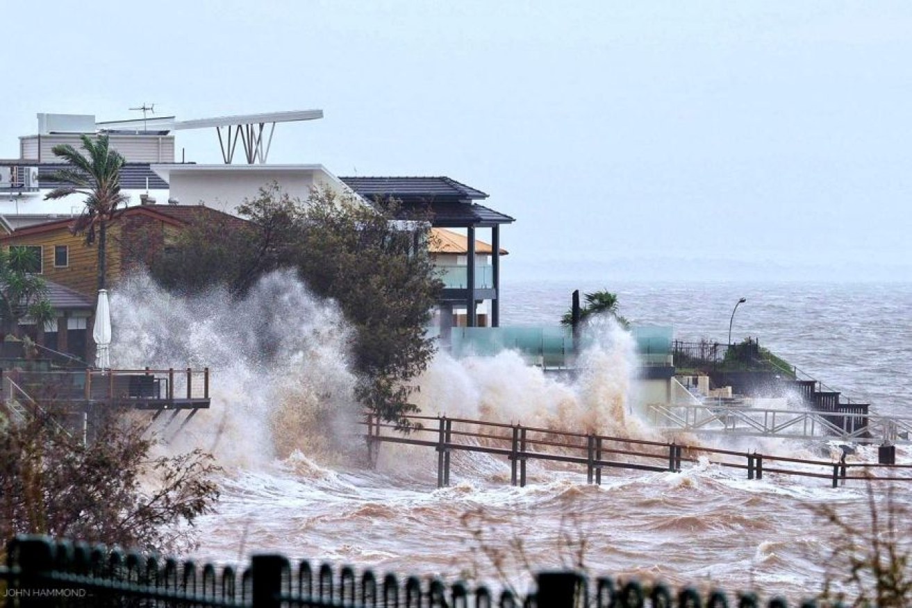
Waterfront homes at Scarborough in the Moreton Bay region are lashed by wild weather and big swells.Photo: ABC/John Hammond
The severe weather system that has cut a swathe through the region over the past two days, eroded away some of Australia’s most famous beaches and smashed rainfall records.
Late this morning, it added another blow, with destructive winds causing power outages to thousands of homes and businesses.
At Bribie Island, the swell was so severe that waves broke through the dune on the northern end of the island near Lion’s Park, opposite Golden Beach in the Bribie Island Recreation Area.
Authorities wanted boaties should stay away from the area but if they had to land to do so on the western side of the dune.
The winds cause about 10,000 households across southeast Queensland to lose power.
Brisbane reported wind gusts of up to 89 kmh late this morning
Meteorologist Dean Narramore said torrential rain and damaging winds would continue to affect areas from Brisbane to Coffs Harbour.
“Flash and riverine flooding and coastal erosion are expected to worsen today,” he said.
He said the erosion was “ongoing” at several beaches in southeast Queensland and northern NSW.
“Inundation of seawater into low lying areas is also a concern,” he said.
“This is a major coastal erosion event and coastal communities need to be on high alert.
More than 700 mm of rain has fallen at Upper Springbrook over the past 48 hours.
Authorities have warned that the extreme weather will continue to intensify with the dangerous rainfall and strong winds to continue unabated overnight.
In northern NSW, four people have been rescued, including a woman who was swept away when she tried to leave her car after getting caught in floodwaters.
The rain has produced significant overland flash flooding with more flooding likely to continue even after the worst of the rain subsides.
Lifesavers have warned the intense weather could create permanent rips along beaches that were previously safe.
Gold Coast Mayor Tom Tate said that while the city was holding up well, the risk remained.
“From 2pm to 8pm today, we may receive another 300mm rainfall,” he said.
Heavy rain is expected to hit the Gold Coast hinterland catchment areas and Tate urged drivers not to try to drive on flooded roads.
Bureau of Meteorology senior meteorologist Laura Boekel said severe thunderstorm activity was likely to increase from late afternoon in the southeast, with further heavy rain the main risk as it develops.
The weather is being generated by a coastal trough off the southeast coast and a slow-moving upper low over the southeast.
“The focus of heavy falls will be highly dependent on the location of the trough and upper trough, but is likely to be south of Fraser Island contracting to the Gold Coast by this afternoon and easing further from Tuesday,” she said.
A flood watch is current from Hervey Bay to the NSW border and there is a minor flood warning for the Logan and Albert Rivers.
Flooding is also possible along coastal locations and about low-lying areas near Brisbane River.
The bureau is warning about more showers and storms next week, with those conditions continuing right until Christmas.