Batten down: BOM says things are about to get rough
Much of southeast Queensland could be lashed by dangerous storms which have the potential to inflict flash flooding, giant hail and destructive winds.
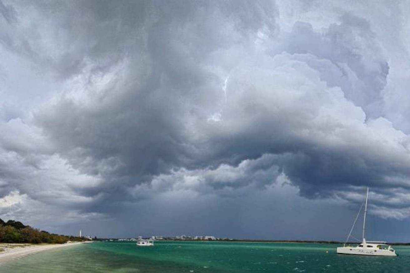
After a wild weekend, the east and north coasts are bracing for more storms in the coming days. Photo: ABC
Severe thunderstorms and isolated “supercells” are possible for areas between Toowoomba and the Sunshine Coast and north to Bundaberg throughout Tuesday, the Bureau of Meteorology reported.
“It’s expected to be most active in the afternoon and as we head into the evening,” meteorologist Rosa Hoff said.
If severe thunderstorms develop, they’re likely to whip up severe weather, such as intense rain and massive hail stones.
“That could include damaging wind gusts in excess of 90 km/h or destructive wind gusts in excess of 125 km/h,” Ms Hoff said.
The storms could also bring hail, measuring more than 5cm, and heavy rain that could lead to localised flash flooding, she added.
“The threat of the storm development does extend overnight and will continue into tomorrow morning,” she said.
Queensland Fire and Emergency Services have warned people to move their cars under cover and secure loose outdoor items.
The Bureau of Meteorology (BOM) said severe thunderstorms could stretch from the southeast corner into northern parts of Queensland today.
“You’re talking the trifecta — large hail, damaging winds and heavy rainfall,” BOM forecaster Felim Hanniffy said.
“There’s potential for some of these storms to have destructive wind gusts, giant hail and very, very heavy rainfall.
“We’re talking about the high-end severe potential with these systems,” he said.
Hanniffy said the dangerous conditions would most likely develop around central and southeast districts during the afternoon and early evening.
“Probably the Wide Bay-Burnett and inland of the Sunshine Coast area will be a particular focal point for the really nasty stuff,” he said.
“Really, it’s the type of day where all areas about the southeast will be a risk to at least some kind of severe storm activity.”
Hanniffy said there would a risk of severe weather again tomorrow, but conditions would stabilise later in the week.
It will be an anxious wait for households in the southeast still cleaning up after wild weather on Sunday.
‘There’s a tree in your roof’
When a severe hailstorm tore through the Ipswich suburb of Chuwar on Sunday, local resident Mark Bataev was at the park with his dog.
“About a minute into it, my neighbour called me, ‘There’s a tree in your roof,’” Bataev said.
“I couldn’t help but laugh.
“I got home, went inside and found a bit of a gum tree through the roof and into the lounge room.
“You can see the sky straight out through [the roof].
“If it had come down while I was standing there, it could have been a different story, but it’s lucky I wasn’t home.”
Bataev said SES volunteers covered the hole in the roof, but the damage had cut off all the lights in the house.
At the height of Sunday’s storm chaos, 33,000 homes and businesses were without electricity after power lines came down.
Bataev said the experience had given him a taste of the state’s wild weather.
“It’s the biggest storm I’ve been in — I moved up to Queensland last year and it’s the first time I’ve experienced something like this,” he said.
– additional reporting ABC / Lily Nothling