Restrictions come off, winter woolies go on as icy blast arrives for weekend
A day trip to the beach seems unlikely for Queenslanders on their first day of COVID-19 freedom with a cold snap tipped to plummet minimum temperatures into single digits over the weekend.

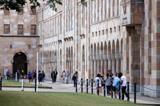
Rug up Australia, wintry weather is on the way from the south all the way to Queensland. (Photo: ABC)
The Bureau of Meteorology (BOM) even expects sub-zero figures near the NSW border while frost is expected along the Darling Downs.
Grace Legge, senior forecaster at the Bureau of Meteorology, said the “strong wintry blast” was the result of a very large low and cold front making its way through.
“Behind the system we’ve got these very strong southerly winds that are really pushing up an air mass that is coming from very far south of Australia, and all that cold air is now likely to stream across the south-east later this week,” she said.
“We keep those southerly winds for multiple days, increasing the cold every day.”
That build-up of cold weather is threatening the record books.
Thursday is set to be the coldest day, with parts of northern South Australia, north-west New South Wales and south-west Queensland forecast to record their coldest April day since the 1960s or 1970s.
Some places are forecast the following day to endure their coldest May day since 2000.
With the cold front’s passage comes the risk of storms.
Strong wind gusts are expected ahead of the change, with the potential for small hail behind.
“We could see thunderstorms through parts of Victoria, New South Wales on the Wednesday,” Ms Legge said.
By Thursday the thunderstorms are forecast to extend into Queensland.
This is a complex frontal system with the potential for multiple lows as well as further troughs and even fronts, with multiple waves of colder air coming through.
“Where those lows deepen will impact where we see some of those heavier falls and especially those stronger winds as well,” Ms Legge said.
After weeks of stay-at-home restrictions, Queenslanders will be able to hit the beach, parks and even have a picnic from this weekend.
Residents can wander up to 50km from home but only mingle with members of the same household in public.
But choosing what time to head-out, where to go and what to pack will be a mission in itself.
Overnight temperatures on the Gold Coast are expected to drop to just seven degrees on Saturday while it will be a brisk nine degrees in Brisbane and eight on the Sunshine Coast.
The maximum temperatures will also take a hit with the Gold Coast dipping to 23 on Saturday and 22 degrees in Brisbane.
It may pay to pack not just a picnic blanket but also one for yourself with the temperature in the Granite belt town of Stanthorpe to hit a low of minus two degrees on Saturday and Sunday with a high of just 15.
“The Darling Downs will see that cold air quite early on Friday and a significant drop in their maximum temperatures,” said BOM forecaster Peter Markworth.
“Stanthorpe is looking at a 10-degree drop in its maximum from 25 to 15 on Friday and they can expect a minimum of negative two degrees on Saturday morning.”
He said, except for far north Queensland, minimum temperatures across the state will be either low teens or, predominantly, single digits.
-AAP
Additional reporting by ABC / Kate Doyle