Rain, glorious rain: It’s just like Christmas, only wetter
A band of storms has caused flash flooding and traffic disruptions in southeast Queensland while graziers say rain in central western Queensland is the best they have seen in years as it continues to fall across drought-affected parts of the state.
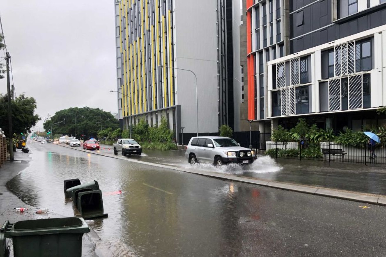
The deluge caused flash flooding in South Brisbane. (Photo: ABC News: Craig Andrews)
A severe weather warning for heavy rainfall across Brisbane, Redland City, Logan, the Gold Coast and Scenic Rim has now been cancelled.
There are delays of up to 30 minutes on all Brisbane City Council buses — earlier today the delays were up to an hour.
It comes as parts of the Wide Bay and Burnett regions received more than 200mm of rain.
Tin Can Bay recorded 228mm since 9:00am yesterday, while nearby Mt Bilewilam received 237mm.
Teddington Weir near Tiaro and Lonesome Creek near Theodore have each had 160mm and Eumundi on the Sunshine Coast had 109mm.
Bureau of Meteorology senior forecaster Gabriel Branescu said the rain would start to move south from today.
“Heavy falls are possible in southern districts towards the Gold Coast and hinterland areas including Springbrook, where we may see three-digits rainfall,” Branescu said.
Brisbane has seen much lighter rain so far but is expected to get 50-100mm in the metro area today.
He said the wet weather should moderate somewhat on Friday before intensifying again over the weekend.
“The rainfall should increase again on Sunday as the next upper trough will arrive in the southeast, so Sunday and Monday it may pick up again,” Mr Branescu said.
Follow-up rain key for farmers
Queensland farmers said they were thrilled with this week’s downpour but were counting on some solid follow-up rain.
Grazier Larry Farquar, from Katrina Station near Rolleston in the Capricornia region, said 72mm fell in the space of three hours late on Tuesday night.
He said that was the biggest rainfall there in two years.
“It’s unreal — it’s just like Christmas but better, it’s just great,” Farquar said.
“February 20, 2018, was the last time we got over an inch in a 24-hour period and we well and truly beat that — I almost forgot what it’s like to have such a big fall in one go.”
Farquar said he was hopeful the BOM forecast for more rainfall panned out.
“We certainly wouldn’t knock any back — hopefully, we can just fill the gaps this week throughout Queensland,” he said.
“There’s still a lot of people still hanging out for a drink that have been through years of drought now, so hopefully everyone can get a bit of a drop this week.”
Kerwee Grazier Liam Payne has 2000 head of cattle on his properties near Eidsvold in the North Burnett.
He recorded 45mm of rain in the last two days and said it was the first decent rain since early last year.
“It’s been a pretty crook year. We’re not out of the woods here by any stretch of the imagination,” he said.
“It gives you a bit more of a positive outlook. We were looking down the barrel of having to early wean a bunch of calves and selling off young cattle and probably not meeting market specs.
“Now those plans can go on hold for a little bit hopefully with some more rain.
“I’d like to see 4 or 5 inches (101 to 127mm) of rain in the next six weeks. That’d be great to fill some dams, run some creeks.”
But North Burnett Mayor Rachel Chambers said while the rain had transformed parts of the region from brown to green, others continued to miss out.
“The storms and rains have kept their line, so I celebrate with those who have got the rain and commiserate with those who haven’t,” she said.
“When the country has that rain — holy moly it looks amazing, the green.
“I saw cattle walking through knee-high grass driving into Monto but I’m also very aware that we still have parts of the region looking like a dust bowl and I feel for everyone there.”
Chris Turnbull manages the Lower Landsdowne Merino sheep property just south of Tambo and says almost 100mm was recorded early late on Tuesday night and into the early hours of yesterday.
“We had 90mm overnight, a pretty hard and fast storm and that’s on top of our 90mm total for earlier in January,” he said.
“It will bring up a lot of grass and set us up for this 2020 season and if we get follow-up rain it will hopefully bring our pasture back into that normal season, and we can bring some stock numbers back up again,” he said.
“We’ve been very fortunate to get the rain we’ve had and just counting our blessings, I suppose.”
Glenn Roberts, the manager of the Gladys Downs cattle property at Augathella, north-east of Charleville, said they had clocked up more than 100mm so far this week.
“At the homestead, we ended up with 90mm and the day before we had 27mm at the house, so over the two-day period, we’re up to 117mm,” Roberts said.
“There’s another rain gauge 4km away from the house and there was 104mm there on Tuesday night — it started about midnight and went for about two-and-a-half hours — the heavy stuff.”
“The last decent rain we’ve had is back in March last year when Cyclone Trevor came through, then we’ve had nothing,” he said.
Passionfruit and strawberry grower Tina McPherson, at Elliott Heads in the Wide Bay region, said the rain had given everything a boost.
“It was just beautiful to hear it on the roof — we felt that we had missed out on some of the January rain that the greater Bundaberg region had got and then on Tuesday night the heavens just opened,” McPherson said.
“I think we got about 55mm and I think most of that poured in through windows that I haven’t closed in about a year.
“People who’ve been in this area a lot longer than me will tell you that we really have never had a drier season in their living memory of over 50 years in our particular region.”
-ABC