Eye in the sky: World-leading project keeps watch on Gold Coast ‘jewels’
The proliferation of Gold Coast high-rises has found a new benefit to the city – helping save the strip’s famous beaches, and potentially its beach users, from Stradbroke Island to the Tweed.

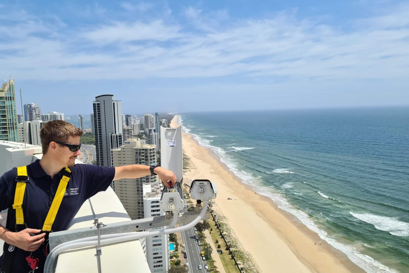
Engineer Chris Drummond adjusts part of the world-leading beach monitoring system now protecting Gold Coast beaches (Photo: Geoplex)
The most advanced beach monitoring system in the world now covers 30km of the Gold Coast’s coastline to detect near real-time beach and ocean issues including erosion, tidal surges, and even sharks.
The network of 45 cameras has been installed along coastal high-rise rooftops and the Gold Coast’s famous yellow lifeguard towers, providing live feeds of the coastline and ocean from the Tweed River Entrance to South Stradbroke Island.
Under the new system, previous black spots are now covered and all sandy-beach areas along the coast can be mapped.
The work is a collaboration between the University of NSW Water Research Laboratory and geospatial mapping specialists, Geoplex, who were engaged by the City of Gold Coast to help monitor increasing risks to the city’s tourism jewel, such as storms, erosion and climate change.
The combined tourism and surfing industries, both heavily reliant on safe and healthy beaches, are worth an estimated $7.5 billion annually to the Gold Coast economy.
The camera network provides information that is analysed and displayed on a dashboard of live and emerging beach and ocean issues. It allows users to remotely see up-to-the-minute feeds as well as developing trends impacting the Gold Coast’s famous stretch of coastline including sand movement, erosion and storms. It also shows tides, water depths, artificial reefs, seawalls, surfer safety and sharks.
Geoplex NSW Business Manager Bill Martin said the award-winning system was the most sophisticated and large-scale coastal monitoring system in the world.
“The development of an interactive web dashboard allows users to see the latest imagery and to interact with data records on maps and plots,” Martin said.
“This data is automatically analysed, in combination with other environmental conditions such as waves and tides, to provide real-time metrics on beach health and climate risks.”
Geoplex geospatial consultant Brittany Dahl said the cameras showed a near real-time feed as well as delivered data for geospatial mapping.
That meant users could simply measure the response of the coastline to storm events, including how much sand was lost to beach erosion, the impacts of waves, and the effectiveness of artificial reefs and seawalls, Dahl said.
It also meant it was easier to monitor beach conditions for user safety, such as rips, whether beach goers were using patrolled areas or even sharks.
“It’s about trying to deliver a better system so someone doesn’t have to go and visit the beach, it can all be done remotely, quickly and simply,” Dahl said.
Principal Coastal Engineer at UNSW and Project Manager, Matt Blacka, said the project took beach monitoring systems that have been used for the past 20 years to the next level.
“When our team started this new project, we really wanted to stretch the envelope and ultimately develop a product that was much more useable for council,” Blacka said.
“This system improves the visualisation of remote beaches, improves accessibility and enables better use of the imagery and data products. We’re now able to look at a much broader range of data including beach user numbers and locations, wave breaking characteristics, beach safety and overall beach health. It’s no longer just about beach erosion and accretion.”